PowerPoint and Keynote·6 min read
How to Ungroup a PDF Map, and Why Ungroup Is Grayed Out
There is no group inside a PDF page to break apart, which is why the command is grayed out. The fix is not a menu path — it is a different file, one where every county is already its own shape.

Ungroup has nothing to release
You cannot ungroup a PDF map, because a PDF page does not contain groups. A page is a single content stream — a long list of painting operators and coordinates that say "fill this path, stroke that one, then place this image here." Nowhere in the format is there an element declaring that forty shapes belong together. PowerPoint and Illustrator have groups because their own document models have groups. PDF is not one of them.
That is why the command fails in the most literal way available: in PowerPoint it is disabled, and in Illustrator it releases a clipping mask, which is a different mechanism that also has nothing to do with the counties you are trying to separate.
The workable answer is short. If you need one shape per county, you need geometry that was authored as separate shapes — an SVG, an EMF, or a .pptx in which every county is its own element. Ungrouping that file is one keystroke and reversible. Turning a PDF page into that state is not a keystroke; it is a rebuild.
Three doors, and what is behind each
| What you drop on the slide | Into | You get | What Ungroup does |
|---|---|---|---|
| A PDF page | PowerPoint | One picture, or one embedded file object | Nothing — the command is disabled |
| A PDF page | Illustrator, File → Open | Paths, usually inside a clipping mask | Releases the mask, not the page |
| A PDF page | Inkscape, File → Import | Paths plus whatever grouping the page happened to use | Works, on those groups only |
A .pptx deck | PowerPoint | Every county as a shape, wrapped in one real group | Yields every shape, each one named |
Read the last row twice. The file that behaves the way people expect a "PDF map" to behave is not a PDF. It is the deck the PDF was exported from, or a file that was never exported in the first place.
What PowerPoint does with a page you hand it
Whether you use Insert → Object → Create from File or drag the file onto the canvas, the result is a single object. Right-click it and the diagnosis is immediate: the Group submenu is disabled, and nothing else on the menu offers to break it apart. If PowerPoint painted the page you get Save as Picture and Edit Alt Text; if it embedded the file you get Package Object and Convert. Either way the object is one rectangle with eight handles. Drag a corner and all three thousand boundaries scale together, which is either exactly what you wanted or the precise problem you were trying to escape.
There is no menu path inward. Picture Format gives you crop, transparency, artistic effects and alt text; none of them reach the paths. PowerPoint never opens the PDF content stream — it paints the page once at insert resolution, or embeds the file and shows the first page. So if a search result told you to right-click and choose Ungroup, that instruction was written for a different kind of file, most often a downloaded SVG or a vendor's deck. It is not a matter of finding the right submenu.
What Illustrator's ungroup actually releases
Illustrator is the one mainstream tool that genuinely reopens a PDF as editable artwork, and it is worth knowing exactly what it hands back. File → Open, pick the PDF, and the Import PDF dialog asks two questions that matter: Crop To (Bounding Box, Art, Trim, Media) and Pages. Choose the page and open it.
What arrives is a <Clip Group>, not a set of counties. A page almost always clips its content to the page box, and editors represent that constraint as a group carrying a clipping path. Object → Clipping Mask → Release (Command/Ctrl+Option/Alt+7) takes the clipping path off. Only then does Object → Ungroup (Command/Ctrl+Shift+G) have a group to break.
Two separate releases, two separate mechanisms, and at the end of both you own a few thousand Path objects. That last part is the real cost. In the Layers panel, Maryland and Virginia are both <Path> until you click one and count its position in the stack.
A group in a deck is an element; in a PDF it is a description
The difference is visible in the file itself. A .pptx slide is XML, and a group is a tag wrapping its members:
<p:grpSp>
  <p:nvGrpSpPr>…</p:nvGrpSpPr>
  <p:sp>
    <p:nvSpPr><p:cNvPr id="5" name="Texas"/></p:nvSpPr>
    …
  </p:sp>
  <!-- 52 more -->
</p:grpSp>
Each shape carries its own name, and that name is what Home → Select → Selection Pane lists. A PDF has no equivalent field — a path's only identity is its offset in the content stream.
The numbers are worth having. This is the whole survey, on both decks:
import re, zipfile

def survey(deck, slides):
    z = zipfile.ZipFile(deck)
    for i in slides:
        xml = z.read(f'ppt/slides/slide{i}.xml').decode()
        shapes = [s for s in re.findall(r'<p:sp>.*?</p:sp>', xml, re.S)
                  if '<a:custGeom>' in s]
        names = [re.search(r'<p:cNvPr id="\d+" name="([^"]*)"', s).group(1)
                 for s in shapes]
        groups = len(re.findall(r'<p:grpSp>', xml))
        pts = len(re.findall(r'<a:pt x="-?\d+" y="-?\d+"/>', xml))
        print(f'{deck} slide {i}: {groups} group, {len(shapes)} shapes, '
              f'{len(set(names))} unique names, {pts} points')

survey('dist/us-states--slate.pptx', [1, 5])
survey('dist/us-counties--slate.pptx', [1])
dist/us-states--slate.pptx slide 1: 1 group, 53 shapes, 53 unique names, 11225 points
dist/us-states--slate.pptx slide 5: 1 group, 53 shapes, 53 unique names, 11225 points
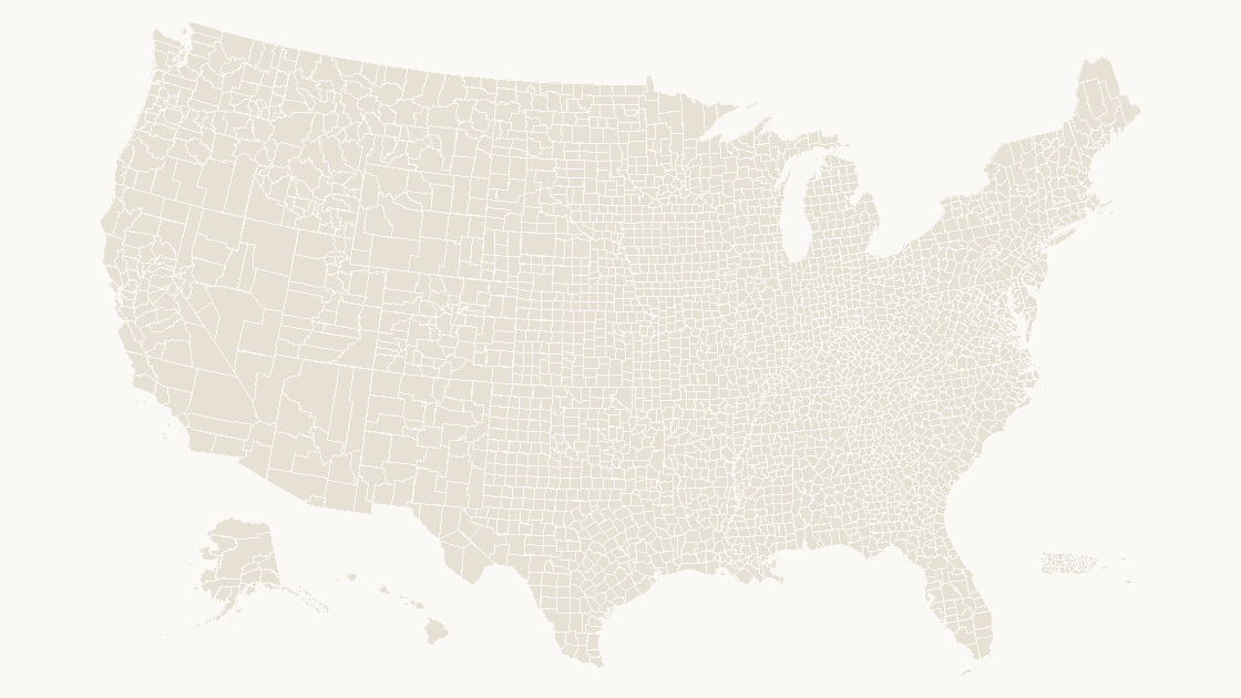
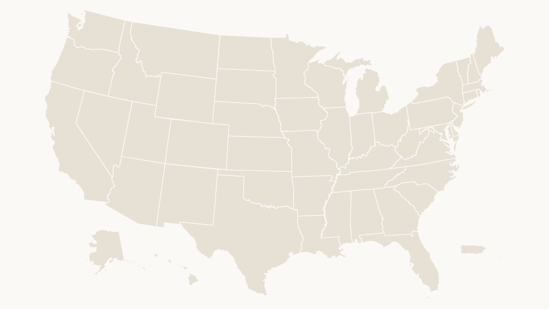
dist/us-counties--slate.pptx slide 1: 1 group, 3225 shapes, 1963 unique names, 51090 pointsFifty-three shapes on a state slide — the fifty states plus the District of Columbia, Puerto Rico and the U.S. Virgin Islands — one name each. Three thousand two hundred twenty-five on the county slide, against 3,235 county features in the source data, because a handful of counties are stored as a single merged shape. And only 1,963 of those names are unique, because Washington County exists thirty times, Jefferson twenty-five, Franklin twenty-four. Shape names are labels, not keys; a real join needs a code, which is why the FIPS discussion is a separate article on this site. What matters here is the structure: every one of those counties is an independently addressable object before you touch anything.
The test that takes ten seconds
Select the map and open Home → Select → Selection Pane.
If it shows one row, you have a picture and no amount of menu-hunting will change that. If it shows 3,225 rows, you already have what ungrouping was supposed to produce, and the group around them is a convenience rather than an obstacle.
You probably do not need to ungroup at all
Most searches for "ungroup a PDF map" come from someone who wants to recolor one county. That does not require a structural edit. Click the map once to select the group, click the shape a second time to select it inside the group, then use Shape Format → Shape Fill. Holding Ctrl while clicking does the same in one step on Windows, Command on macOS. The color walkthrough covers the rest of that path.
Ungroup is the right move for structural work: deleting a shape, merging two, sending a subset to a colleague, or driving fills from a data column where you need one flat list of objects. In the state deck, slide 5 shows what that list looks like after a five-class fill — 11 shapes at #2B577C, 11 at #94B5CF, 11 at #E8EFF5, 10 at #5C88AC, 10 at #C6D8E7. Somebody had to select those individually or by attribute, and either way the objects had to be separate first.
The route that keeps the shapes
Ask the person who made the map, or the portal that published it, for the vector original: SVG, EMF or the source deck. An SVG drops straight into Microsoft 365 through Insert → Pictures and arrives with a Convert to Shape button on the Graphics Format tab; Illustrator and Inkscape open the same file with one path per region. The fifty-state set and the 3,235-county set ship as decks precisely so this step is unnecessary — the geometry is already a group of named shapes, and one Ctrl+Shift+G is the end of the story rather than the beginning of an afternoon.
If the only artifact left is the PDF, be honest about the ceiling: Illustrator will give you paths without names, Inkscape will give you paths without names, and a raster export gives you pixels without paths. Rebuilding identity from position is possible and slow, and it is the reason the third-party PDF is the worst starting point for a map you intend to edit rather than display.
A 300 DPI re-export of the PDF does not help an editable file problem. It raises the pixel count of a picture; the paths are still inside a page nothing can open as shapes.
Why is Ungroup grayed out on my map in PowerPoint?
Can Illustrator ungroup a PDF map into counties?
What file should I ask for instead of a PDF?
Do I have to ungroup a map just to color one county?
Shapes on arrival, no PDF in the middle
Fifty-three state shapes or 3,235 county shapes, each one named and independently fillable. $9.99, one-time download.
See the state mapQuestions
Why is Ungroup grayed out on my map in PowerPoint?
Can Illustrator ungroup a PDF map into counties?
What file should I ask for instead of a PDF?
Do I have to ungroup a map just to color one county?
Written in-house. Boundary counts are checked against the published files, and every figure on this page can be reproduced from the source named in it.