Press and media kit
Everything needed to write about GeoSlides without emailing first: a description in three lengths, the numbers behind it, the logo files, and how to link to the site. If something is missing, ask — the address is at the bottom.
About GeoSlides
GeoSlides sells editable map templates for presentations. The difference from a picture of a map, or from PowerPoint's own map chart, is what the file contains: the map is made of ordinary vector shapes, one per county, province or district, each carrying the name of its area and the official code for it. That is what allows a single area to be recolored, and what allows a reader's own figures to be joined to the map instead of typed beside it.
Three lengths below. Take one as it is rather than paraphrasing it: the numbers are checked against the catalog on every build.
GeoSlides sells editable map templates for PowerPoint: each one is a .pptx of named vector shapes, so every county or province can be recolored, not just a picture.
GeoSlides sells editable map templates for PowerPoint, Keynote and Google Slides at $9.99 each. The map is ordinary PowerPoint shapes rather than an image, so ungrouping it gives one shape per county, province or district, each named and carrying its official geographic code. 901 templates cover the United States, the United Kingdom, Spain and China.
GeoSlides is a template library for people who need a map in a presentation and do not use GIS software. Each template is a .pptx containing the map as native vector shapes — one per county, province or district — rather than as an image or a chart, so a single area can be recolored, relabelled or deleted, and data can be joined on the official code each shape carries. Templates cost $9.99 as a one-time payment, come in three color themes, and are built from official boundary data: U.S. Census Bureau files for the United States, Office for National Statistics boundaries under the Open Government Licence for the United Kingdom, CNIG boundaries under Orden FOM 2807/2015 for Spain, and the chinaadminboundaries dataset for China. The catalog holds 901 templates across the four.
Key facts
| Fact | Value |
|---|---|
| What is sold | Downloadable PowerPoint map templates (.pptx) |
| Price | $9.99 per template, one-time payment, no subscription |
| Catalog | 901 templates: 103 for the United States, 82 for the United Kingdom, 144 for Spain (in English and in Spanish) and 363 for China |
| In each template | Three .pptx files, one per color theme, eight slides in each |
| Format | .pptx. Arial only, no animation, no SmartArt, no chart, no add-in, and no connection needed to edit |
| Joining data | GEOID (United States), GSS code (United Kingdom), national code (Spain), GB code (China) |
| Boundaries | U.S. Census Bureau 2025 cartographic boundary files, public domain; Office for National Statistics under the Open Government Licence; CNIG under Orden FOM 2807/2015; the chinaadminboundaries dataset |
| Buyer license | Commercial use in any number of presentations; resale of the files is not permitted |
| Refunds | 14 days, for any reason |
| Payments | Waffo Pancake as merchant of record, which also handles sales tax |
| Operated by | Liu Guo, China |
| Free sample | One deck from each catalog, at /samples/, no email required |
Logos and screenshots
The mark is a square: a map divided by two lines, with a small ridgeline in the lower-right quarter. It is legible down to 16 pixels. There is no horizontal lockup — set the word GeoSlides beside the mark in whatever typeface your article already uses.
- Mark, SVG — for print and for any size on screen.
- Mark, 1024×1024 PNG — for article thumbnails.
- Mark, 512×512 PNG — for directory listings.
- Map slide, 1120×630 PNG — a screenshot of a template, for a card image.



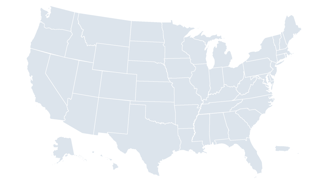
Screenshots of any template in any of the three themes can be sent on request; the preview images on every product page are the same artwork and may be used without asking.
How to write our name
GeoSlides, one word, capital G and capital S. The domain is lowercase: geoslides.com. It is not “Geo Slides” or “Geo-Slides”, and the map files are “templates” rather than “maps” when the format matters.
Linking to the site
Link to the page that is actually relevant rather than to the home page — a piece about county-level data should point at the county maps, and one about editing should point at the guide. Nofollow is fine; so is a plain URL. There is no affiliate program and no paid placement, so nothing here has a tracking parameter.
<a href="https://geoslides.com/templates/us-counties/">editable US county map template for PowerPoint</a>Anchor text that describes what the page is reads better and lasts longer than the brand name alone.
What we can send on request
- Screenshots of any template, in any theme, at whatever size the layout needs.
- The .pptx itself for review — the sample decks at /samples/ are the same files a buyer gets.
- Boundary numbers behind any map: how many areas, which release, which publisher, and what changed between releases.
- A short interview by email, about building a template business on public boundary data.
Contact
One address for everything, including press: hello@geoslides.com. The operator is Liu Guo, China.