Map data·3 min read
How Many Counties Are There in the United States? 3,144
The number is 3,144, and it has only been that since 2022. Here is the count by state, the nine kinds of thing that count as a county, and the arithmetic that gets you from 3,144 to the 3,235 features in the Census file.
The short answer, and the longer one
There are 3,144 counties and county equivalents in the fifty states and the District of Columbia.
Download the Census Bureau's 2025 cartographic boundary file for counties and you get 3,235 features. Both numbers are correct. The 91-feature difference is Puerto Rico and the four island territories, which are in the national file and are not in the fifty states.
That distinction matters more than it sounds like it should. A dashboard built from the national file and checked against a 3,144-row population table will look wrong by exactly 2.8%, and someone will spend a day looking for the missing counties in Ohio.
| Scope | Features | What is in it |
|---|---|---|
| Fifty states and D.C. | 3,144 | The number people mean by "US counties" |
| Puerto Rico | 78 | Municipios, not counties |
| Virgin Islands | 3 | Three districts |
| American Samoa | 5 | Two districts, Manu'a, Rose Island, Swains Island |
| Guam | 1 | The whole territory, as one unit |
| Northern Mariana Islands | 4 | Municipalities |
| National file total | 3,235 | Everything above |
Why 3,144 and not 3,143
Most sources still say 3,143. They are not wrong so much as out of date.
Connecticut had eight counties from 1666 until 1960, when they stopped functioning as governments but kept being used for statistics. In 2022 the Census Bureau replaced them with the state's nine planning regions — councils of governments that were already doing the work — and started publishing data at that level.
Eight became nine. The national total moved by one, from 3,143 to 3,144, and almost nobody noticed, because the change was one state and the number looks like a constant.
You can see it in the data rather than taking it on trust. Every other county-level unit in the file carries LSAD code 06 (county), 15 (parish), 25 (city) and so on. The nine Connecticut planning regions carry PL, which is the Bureau's code for exactly this kind of statistical substitution.
Nine things that count as a county
"County" is a statistical convenience, not a legal category. The Census Bureau counts county equivalents — units that do the same job at the same level — and in the fifty states and D.C. that comes to nine different kinds of unit:
| Unit | Count | Where |
|---|---|---|
| County | 2,999 | Everywhere except Louisiana, Alaska and Connecticut |
| Parish | 64 | Louisiana |
| Independent city | 40 | Virginia 38, Baltimore, St. Louis |
| Borough | 13 | Alaska |
| Census area | 11 | Alaska |
| Planning region | 9 | Connecticut |
| City and borough | 4 | Alaska: Juneau, Sitka, Wrangell, Yakutat |
| Municipality | 2 | Alaska: Anchorage, Skagway |
| Other (D.C., Carson City) | 2 | District of Columbia, Nevada |
| Total | 3,144 |
Two of these are worth a second look.
Independent cities are the reason Virginia's county map looks nothing like anyone else's. The state has 95 counties and 38 cities that are not inside any county — separate units at the same level, each with its own courts and schools. Baltimore and St. Louis are the only other independent cities in the country. On a county-level map they sit in the middle of a hole in the surrounding county, and on a data table they are rows of their own.
Alaska does not use the word county at all. It has boroughs (organized), census areas (unorganized, drawn by the state and the Bureau for statistics), and four city-and-borough consolidations. A "county map of Alaska" is really a map of thirty units that share a level and nothing else.
The count by state
Texas has 254 counties, Georgia has 159, and Delaware has three. The spread is historical rather than administrative: counties were drawn when a trip to the county courthouse had to happen and come back within a day, so a county tends to be about as wide as that journey.
| State | Counties | Note |
|---|---|---|
| Texas | 254 | The most of any state |
| Georgia | 159 | Second only to Texas |
| Virginia | 133 | 95 counties + 38 independent cities |
| Kentucky | 120 | |
| Missouri | 115 | |
| Kansas | 105 | |
| Illinois | 102 | |
| North Carolina | 100 | |
| Iowa | 99 | |
| Tennessee | 95 | |
| … | ||
| Hawaii | 5 | |
| Rhode Island | 5 | |
| Delaware | 3 | The fewest of any state |
| District of Columbia | 1 | A city and a county at once |
Counting them yourself
The numbers above come from the file, not from a list. This reproduces them in about ten lines, and is worth running before you build anything on top of the data:
import collections, json

gj = json.load(open("cb_2025_us_county_5m.geojson"))
rows = [f["properties"] for f in gj["features"]]

# The island areas are in the national file and are not in the 50 states.
ISLAND = {"AS", "GU", "MP", "PR", "VI"}
main = [r for r in rows if r["STUSPS"] not in ISLAND]

print(len(rows))                                   # 3235
print(len(main))                                   # 3144
print(collections.Counter(r["LSAD"] for r in main).most_common())
# Counter({'06': 2999, '15': 64, '25': 40, '04': 13,
#          '05': 11, 'PL': 9, '03': 4, '00': 2, '12': 2})
If the second number is 3,143, you are on a file published before the Connecticut change. If it is 3,234, one Connecticut region is missing and the geometry is broken at the state line.
Why our slides say 3,225
The county map we sell draws 3,225 shapes, not 3,235, and the difference is deliberate. Puerto Rico and the Virgin Islands are on the sheet, in a Caribbean inset. American Samoa, Guam and the Northern Mariana Islands are not: their ten county equivalents sit across the Pacific, and putting them on the same page as Ohio would shrink the continental map to make room for islands that no presentation needs.
Keep that in mind when you compare a map to a table. A map is a design decision about what fits on a page; the file is the complete record.
Are there 3,143 or 3,144 counties in the United States?
Does the count include Puerto Rico?
Why does Virginia have so many counties?
Is a Louisiana parish a county?
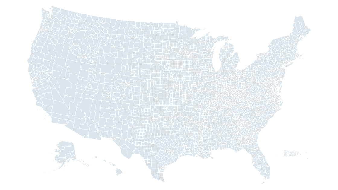
The county map used above
3,225 editable county shapes, each named and carrying its Census GEOID, in eight slides and three themes.
See the county mapQuestions
Are there 3,143 or 3,144 counties in the United States?
Does the count include Puerto Rico?
Why does Virginia have so many counties?
Is a Louisiana parish a county?
Written in-house. Boundary counts are checked against the published files, and every figure on this page can be reproduced from the source named in it.